
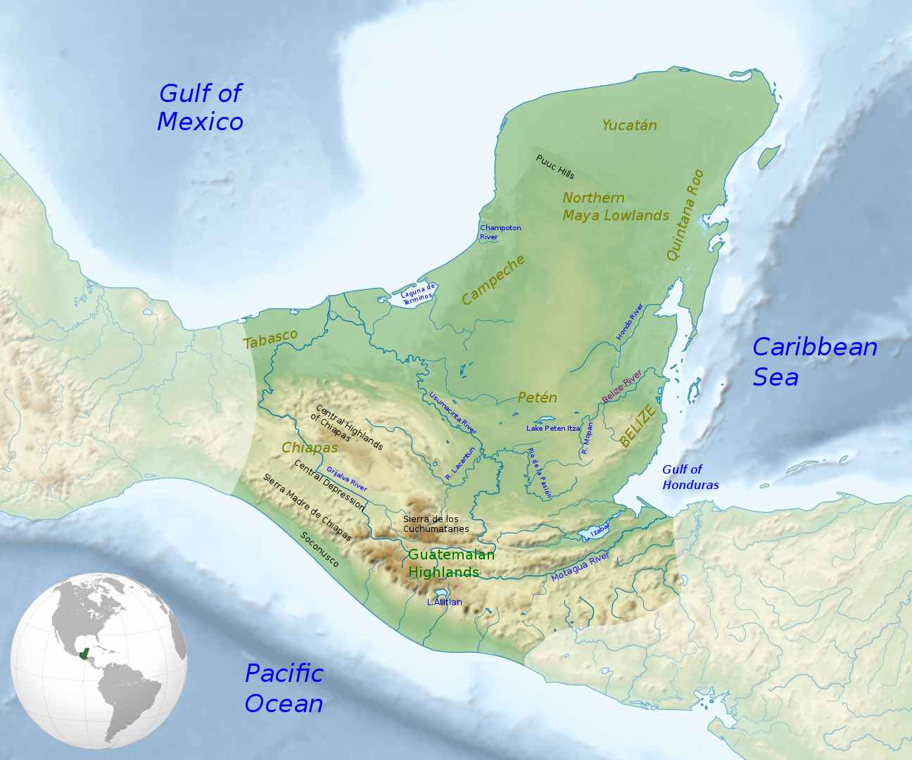
Map of the Maya region, with major rivers, mountain ranges and regions

Full description
This is a retouched picture, which means that it has been digitally altered from its original version. Modifications: Text labels added. The original can be viewed here: https://commons.wikimedia.org/wiki/File:Mayacivilizationlocation_map-blank.svg. Modifications made by Simon Burchell. Sources: ITMB Publishing (1998). Guatemala (Map) (3rd ed.). 1:500000. International Travel Maps. ITMB Publishing Ltd. ISBN 0-921463-64-2. OCLC 421536238México South East (Map) (2nd ed.). 1:1000000. International Travel Maps. Richmond, British Columbia, Canada: ITMB Publishing. 2000. ISBN 0-921463-22-7. OCLC 46660694Sharer, Robert J.; Loa P. Traxler (2006). The Ancient Maya (6th (fully revised) ed.). Stanford, California, US: Stanford University Press. ISBN 0-8047-4817-9. OCLC 57577446.Foster, Lynn (2002). Handbook to Life in the Ancient Maya World. New York, US: Oxford University Press. ISBN 978-0-19-518363-4. OCLC 57319740Coe, Michael D. (1999). The Maya (Sixth ed.). New York: Thames & Hudson. ISBN 0-500-28066-5. OCLC 40771862., CC BY-SA 4.0, https://commons.wikimedia.org/w/index.php?curid=40476910
Comments
to view and add comments.
Annotations
No one has annotated a text with this resource yet.
- typeImage
- created on
- file formatpng
- file size1 MB