Skip to main contentResource added 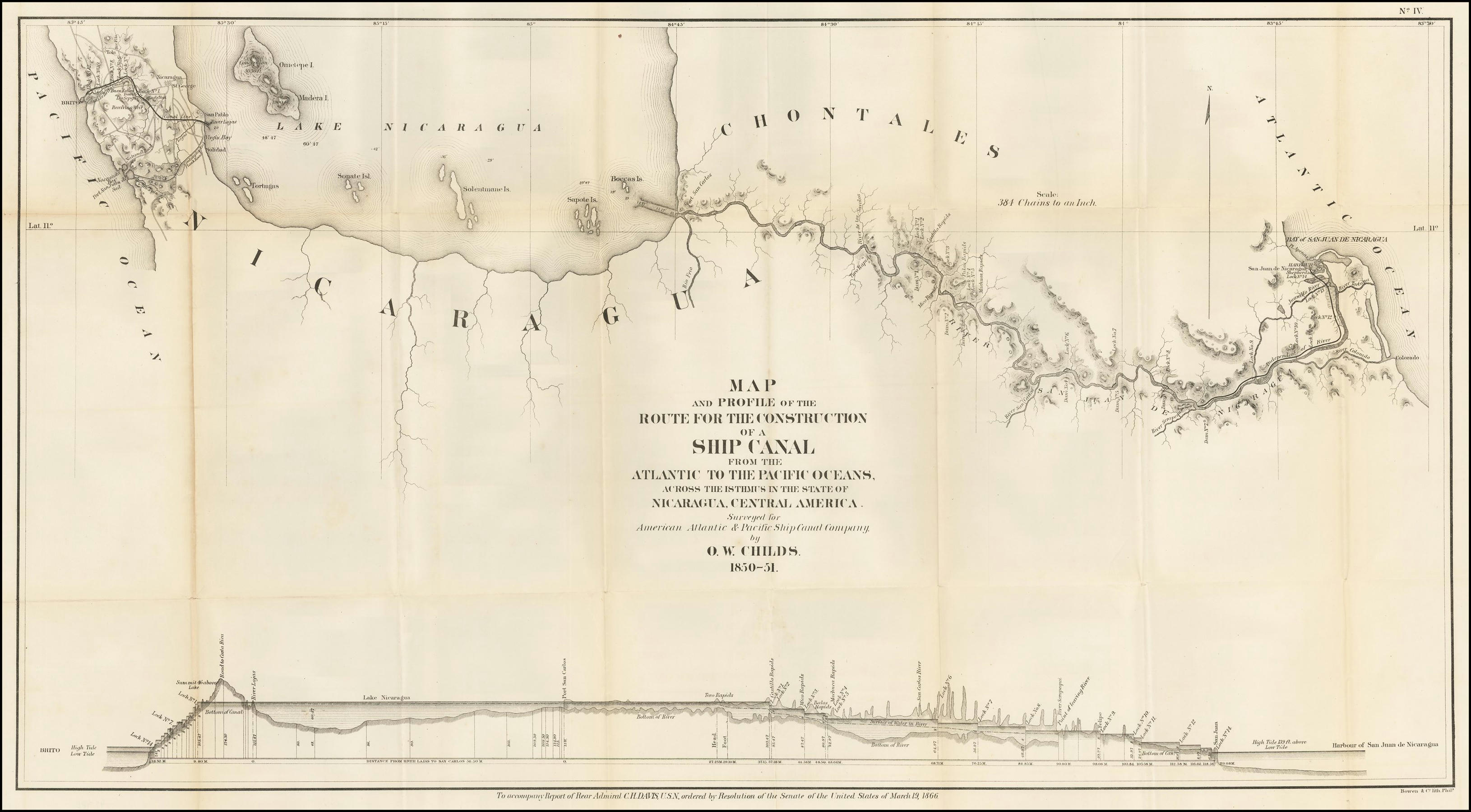

Map and Profile of the Route for the Construction of a Ship Canal
Full description
Map and Profile of the Route for the Construction of a Ship Canal From The Atlantic To the Pacific Oceans Across The Isthmus in the State of Nicaragua, Central America. Surveyed for American Atlantic & Pacific Ship Canal Company. by O.W. Childs. 1850-51. Source: https://www.raremaps.com/gallery/detail/50264/map-and-profile-of-the-route-for-the-construction-of-a-ship-bowen-co. Bowen & Co., Public domain, via Wikimedia Commons, https://commons.wikimedia.org/wiki/File:MapandProfileoftheRoutefortheConstructionofaShipCanalFromTheAtlanticTothePacificOceansAcrossTheIsthmusintheStateofNicaragua,Central_America.jpg
Comments
to view and add comments.
Annotations
No one has annotated a text with this resource yet.
- typeImage
- created on
- file formatjpg
- file size621 kB